


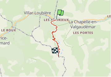
Lacs de Pétarel au départ des Andrieux

frizou83
User

Length
6.8 km

Max alt
2428 m

Uphill gradient
1378 m
Km-Effort
21 km

Min alt
1052 m

Downhill gradient
8 m
Boucle
No
Creation date :
2022-07-12 07:21:53.682
Updated on :
2022-07-12 07:24:53.652
3h36
Difficulty : Difficult

FREE GPS app for hiking
 SityTrail
IGN / Geographical institutes
SityTrail Plus
The world is yours!
About
Trail Walking of 6.8 km to be discovered at Provence-Alpes-Côte d'Azur, Hautes-Alpes, La Chapelle-en-Valgaudémar. This trail is proposed by frizou83.
Positioning
Country:
France
Region :
Provence-Alpes-Côte d'Azur
Department/Province :
Hautes-Alpes
Municipality :
La Chapelle-en-Valgaudémar
Location:
Unknown
Start:(Dec)
Start:(UTM)
275958 ; 4966917 (32T) N.
Comments